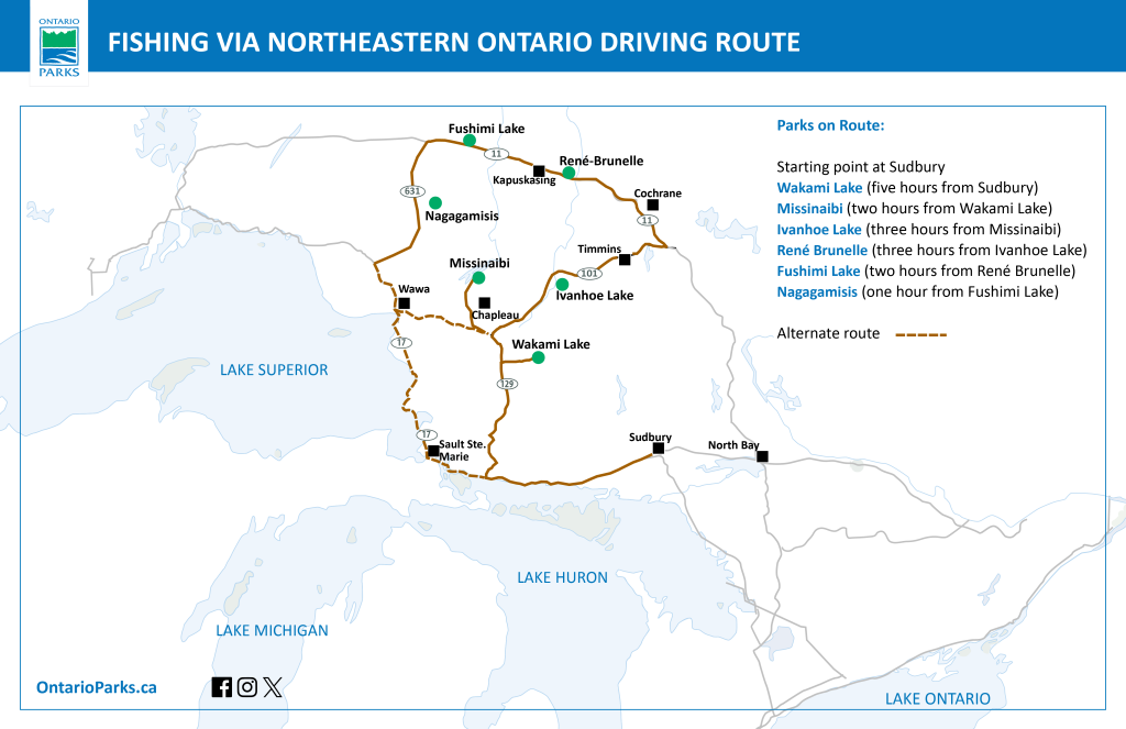
Planning a cross-province adventure? Check out the Ontario Parks Driving Routes.
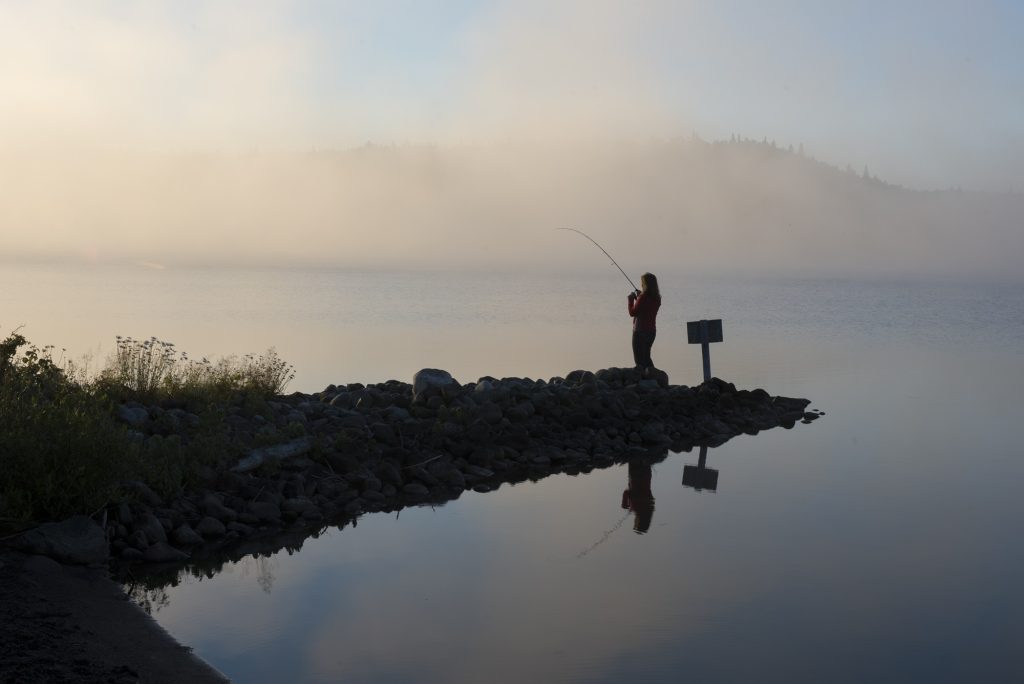
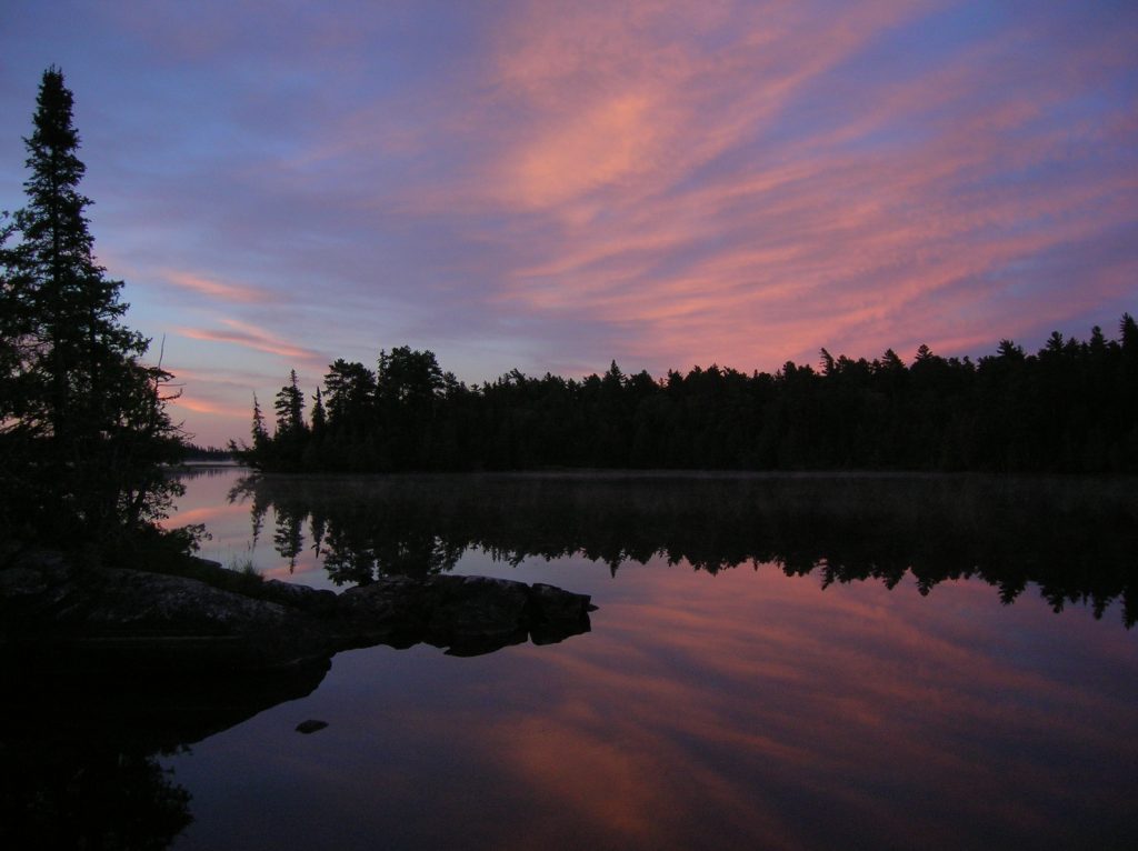
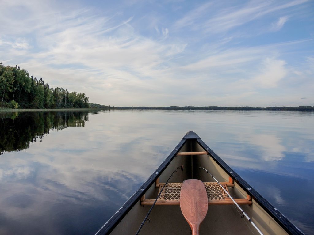
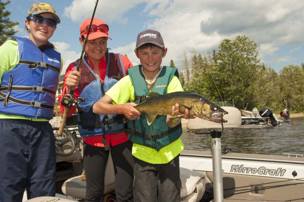
The sound of water, the tug of a fishing line, the crackle of fish filets in a frying pan, and the light of a campfire as another great day fades into a starry night. Sound like where you need to be?
It’s time to get out the maps, rods, and tackle boxes, get the boat ready, and plan a fishing trip to Northeastern Ontario!
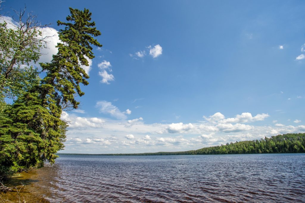
This driving route takes you through Northern Ontario’s stunning boreal forest, stopping off at parks that provide great fishing and family camping opportunities in the summer.
Check it out:
Stop #1: Wakami Lake Provincial Park
Wakami Lake Provincial Park opens May 15, 2026
Nearest community: Chapleau
Driving time: Sudbury to Wakami Lake will take about five hours. Take Highway 17 west from Sudbury, then Highway 129 north at Thessalon, east on Highway 667 towards the hamlet of Sultan for about 26 km, and south on Wakami Park Road.
From Sault Ste Marie, it’s east on Highway 17 to Highway 129, then follow the same directions above. Sault Ste Marie to Wakami Lake is about a four hour drive.
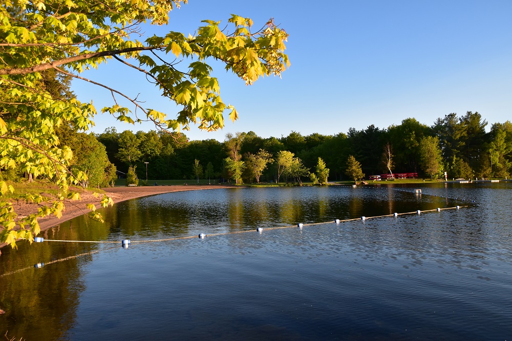
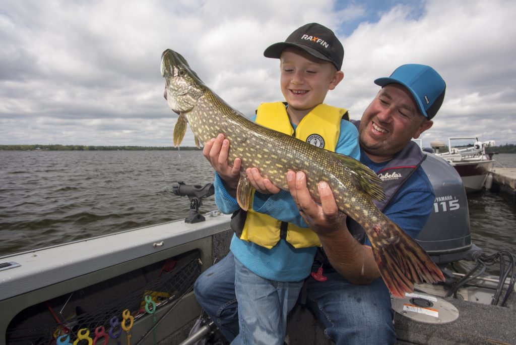
The park: Wakami Lake Provincial Park is famous for its Walleye fishing among anglers in the know.
Park staff across Northern Ontario choose Wakami Lake for their fishing and camping getaways.
The 15 kilometre-long lake is completely surrounded by park, without any cottages or communities along its shores — the only other anglers to share the fishing with are fellow campers!
The park has a quiet, rustic campground off the beaten path. It’s also off-the-grid.
The campground offers plenty of waterfront sites, good docking facilities, and boat/motor rentals. Many campers can pull their boats up to shore right at their campsite.
Stop #2: Missinaibi Provincial Park
Missinaibi Provincial Park opens May 15, 2026
Nearest community: Chapleau
Driving time: Wakami Lake to Missinaibi will take about two and a half hours. Take Highway 667 west, then follow Highway 129 north to Chapleau. In Chapleau, follow Highway 129 to Pine Street. Take Pine Street across the Chapleau River to Lafreniere Road.
Lafreniere Road is a major forest access road and for most of the hour and 40 minutes to the park you’ll travel on a wide, well-maintained gravel road. Follow the Lafraniere Road for 84 km until you get to the park.
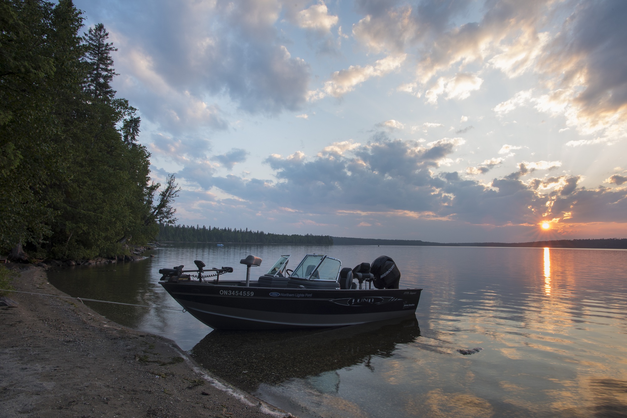
The park: Missinabi Provincial Park is Ontario’s longest park at 500 km long, flowing north from its headwaters to the Moose River and James Bay. But it’s Missinaibi Lake that most anglers spend the most time on.
The campground is accessed from the town of Chapleau, 80 km to the southeast, by a major forest access road. The remoteness of the lake and its size (40 km-long with another bay that’s 20 km long), and the small campground mean that there are plenty of fish to go around for anglers on Missinaibi.
Hook Whitefish, Walleye, Northern Pike, and Lake Trout in this giant lake. Anglers love the large dock system, availability of boat rentals, and a fish cleaning house located conveniently near the park’s day use area.
Barclay Bay Campground is quiet and rustic with just 35 non-electrical sites on the shores of “Big Miss”. The park boasts large, well-treed campsites with basic amenities. The park rents boats, motors, and docking spaces.
Stop #3: Ivanhoe Lake Provincial Park
Ivanhoe Lake Provincial Park opens May 15, 2026
Nearest Community: Timmins and Chapleau
Driving time: Missinaibi to Ivanhoe Lake will take about three hours. Take Lafrenière Road to Monk Street in Chapleau, Monk Street becomes Highway 129, then follow 129 south to Highway 101. Follow Highway 101 east to Ivanhoe Lake Road, then Ivanhoe Park Road until you reach the park office.
The park: wrapping around the eastern shores of Ivanhoe Lake, the park also contains 20 kilometres of the Ivanhoe River, all boatable and fishable. Walleye, Northern Pike, and Yellow Perch are easily caught by boat or canoe in the river or out on the big lake. Lake Whitefish are also caught in the lake.
Ivanhoe Lake also has great beaches. Anglers can cast from the sandy bottom shallows into a sudden drop where lunkers sometimes lurk.
Ivanhoe Lake’s campground is located just off Highway 101, a little over an hour west of Timmins. It has electrical sites, comfort stations with showers, and laundry facilities. Boats and motors are available for rent, and a fish cleaning station is available for visitors’ use.
A bonus: the park lies within the “Spirit Moose” or “White Moose Forest” where residents of the nearby town of Foleyet and park staff often see completely white-coloured Moose, especially in the spring.
Also, for any families with kids visiting Ivanhoe Lake in July and August, weekly Discovery programs are given by the park’s Discovery guide. These programs are great for families looking to discover more about the park and its nature.
Stop #4: René Brunelle Provincial Park
René Brunelle Provincial Park opens May 15, 2026
Nearest community: Moonbeam and Kapuskasing
Driving time: Ivanhoe Lake to René Brunelle will take about three hours. Take Ivanhoe Park Road/Ivanhoe Lake Road to Highway 101. Drive on Highway 101 to the city of Timmins, until reaching Highway 655. Turn north on Highway 655, and take 655 until it meets Highway 11 (Trans-Canada northern route).
You’ll take Highway 11 west to the town of Moonbeam, then Highway 581 north until you get to the park office.
The park: René Brunelle protects the northeast quarter of Remi Lake, one of the largest lakes in the region. The lake lies within the Great Clay Belt, an area of very flat land with a mix of boreal forest and scattered farmland.
Rivers are common, but big lakes are a bit rarer.
The park is known for its fantastic Walleye, Northern Pike, and Small-mouth Bass fishing. Once you’re back on shore, clean your catch at the fish cleaning hut close to the park’s floating docks.
The park’s campgrounds offer electrical sites, a large secluded group camping site, as well as a comfort station with showers and laundry facilities. A boat launch, docks, and a fish cleaning station cover your angling needs.
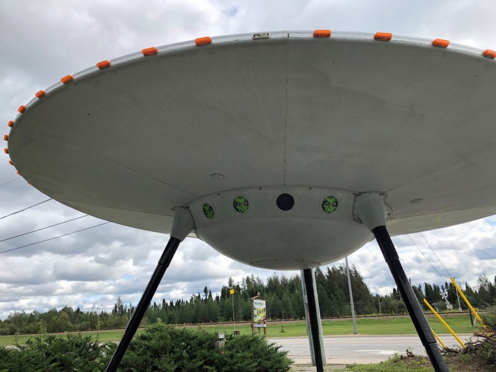
What you’ll like: as you turn off of Highway 11 (the northern Trans-Canada route) at the town of Moonbeam, you can stop at the tourism information centre and check out the flying saucer, which even has little green cosmic travelers peering out the portholes! The town of Moonbeam was even mentioned in a song by the Tragically Hip.
René Brunelle also has weekly Discovery programs given by the park’s Discovery guide in July and August. These programs are great for families looking to discover more about the park and its nature.
Looking to upgrade your stay? Rene Brunelle’s rustic cabin provides a comfy lakeside experience!
Stop #5: Fushimi Lake Provincial Park
Fushimi Lake Provincial Park opens May 15, 2026
Nearest community: Hearst
Driving time: René Brunelle to Fushimi Lake will take about two hours. Take Highway 581 south from the park to Moonbeam, then Highway 11 west for 135 km to Fushimi Road. Turn left onto Fushimi Road, and drive 12.6 km onto Neely Road until arrival at the park office.
The park: Fushimi Lake is known for its Walleye, Northern Pike, Yellow Perch, and Lake Whitefish. A fish cleaning hut located by the boat launch, making cleaning easy!
Fushimi Lake is completely contained within the provincial park. The lake has many bays, islands and even some rivers like the Valentine, which makes for some sheltered fishing opportunities. The park’s seven sand beaches and many rocky points make for great spots for shore lunches.
Fushimi Lake’s quaint campground hosts 61 secluded sites, including 10 new extra-large sites, all with electricity.
What you’ll like: the Fushimi Vibe. Visitors and staff alike say there’s a different feel to Fushimi Lake. It’s got friendly staff and campers, it’s laid back and low-key — a place that just makes you feel relaxed!
Looking to upgrade your stay? Fushimi Lake’s rustic cabin provides a comfy lakeside experience!
Stop #6: Nagagamisis Provincial Park
Nagagamisis Provincial Park opens May 15, 2026
Nearest Community: Hornepayne
Driving time: from Fushimi Lake to Nagagamisis is about an hour. Drive from the park office on Neely Road to Fushimi Road. Take Fushimi Road south to Highway 11, then turn right an follow Highway 11 to Highway 631. Drive south on 631 for 40 km to arrive at the Nagagamisis park entrance.
The park: this park is a must-visit for the fishing crowd. The park is centred on Lake Nagagamisis – its name is Cree for “lake with fine, sandy shores” and is part of a significant boreal forest landscape.
The 15 km-long lake is popular with campers from the region, providing excellent boating and fishing opportunities. The park’s day use area includes a boat launch to access the lake, and a dock for loading.
Campers with waterfront campsites often pull their boats up on shore for easy access during their stay.
What you’ll like: located in the day use area near the boat launch is a fish cleaning station and smoker to smoke and preserve your Walleye, Northern Pike, and Yellow Perch.
Nagagamisis’ two campgrounds are in close proximity to showers, a laundromat, and flush toilets.
Weekly Discovery programs are given by the park’s Discovery guide in July and August. These programs are great for families looking to discover more about Nagagamisis and its nature.
Get out there and catch the big one!
Total driving time for entire trip: 14 hours + travel time from your community to Sudbury or Sault Ste Marie.
Estimated trip duration (full route): it could be weeks if you decided to spend lots of time fishing, boating, eating fish, and sitting around the campfire each evening stargazing and telling stories!
Don’t forget to check out the Ontario Fishing Regulations before you go!
Planning a fish fry? This Guide to Eating Ontario Fish is your new BFF!
Book your trip online!